Geolocate

Borgata Calchesio topographic map

Click on the map to display elevation.

About this map

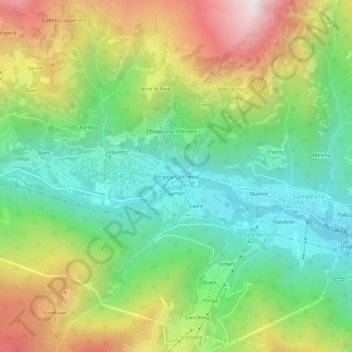
Name: Borgata Calchesio topographic map, elevation, terrain.

Location: Borgata Calchesio, Sampeyre, Cuneo, Piemonte, Italia (44.56190 7.14774 44.60190 7.18774)

Average elevation: 4,491 ft

Minimum elevation: 3,025 ft

Maximum elevation: 6,873 ft

Gear up for your next adventure:

🧣Hiking Neck Gaiter - Multi‑use neck protection for outdoor weather
🥾Hiking Shoes - Durable and comfortable shoes for trail hiking
🧯Emergency Survival Kit - All‑in‑one survival essentials for the backcountry
🏥Hiking First Aid Kits - Comprehensive medical kits for remote trail injuries
🦺Reflective Outdoor Gear - Safety gear for low‑light conditions

As an Amazon Associate, this site earns from qualifying purchases at no extra cost to you.