Geolocate

Festus topographic map

Click on the map to display elevation.

About this map

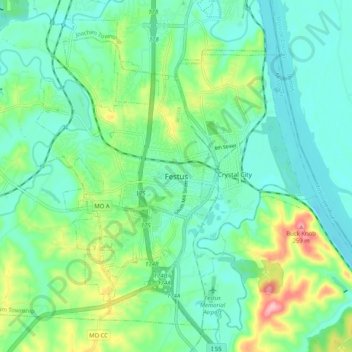
Name: Festus topographic map, elevation, terrain.

Location: Festus, Jefferson County, Missouri, 63019, United States (38.18071 -90.43595 38.26071 -90.35595)

Average elevation: 479 ft

Minimum elevation: 348 ft

Maximum elevation: 843 ft

Jefferson County trails, hiking, mountain biking, running and outdoor activities

Gear up for your next adventure:

🪶Survival Guide Book - Expert advice for emergency preparedness
🦺Reflective Outdoor Gear - Safety gear for low‑light conditions
GPS Sports Watch - GPS watch for running, hiking and training
🌡️Portable Weather Meter - Track weather conditions on the trail
🪶Multi‑Purpose Knife - Useful blade for camp and trail

As an Amazon Associate, this site earns from qualifying purchases at no extra cost to you.