Geolocate
👉 Easily get elevation data in JSON, GeoTIFF and KML formats using Elevation API
Thank you for supporting this site ❤️
Make a donation

Bigaa topographic map

Click on the map to display elevation.

About this map

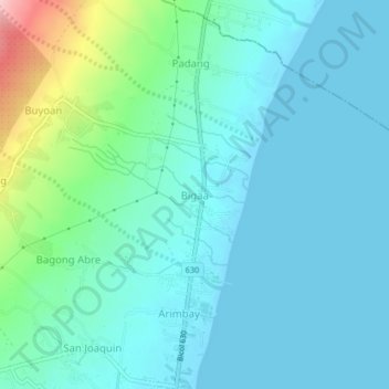
Name: Bigaa topographic map, elevation, terrain.

Location: Bigaa, Legazpi, Albay, Bicol Region, 4, Philippines (13.17547 123.73418 13.21547 123.77418)

Average elevation: 105 ft

Minimum elevation: -3 ft

Maximum elevation: 594 ft

Gear up for your next adventure:

🛰️Satellite Messengers - Emergency SOS and two-way messaging for off-grid adventures
🕶️Glacier Sunglasses - Side shields to protect eyes from high-altitude snow glare
🧺Microfiber Travel Towels - Compact and fast-drying towels for trail use
🦟Ultrasonic Repellers - Create a bug-free zone at your camp or rest stop
🔊Portable Camp Speaker - Music and alerts at camp

As an Amazon Associate, this site earns from qualifying purchases at no extra cost to you.