
Thank you for supporting this site ❤️
Make a donation
Make a donation
Gear up for your next adventure:
As an Amazon Associate, this site earns from qualifying purchases at no extra cost to you.
Cubijíes topographic map
Click on the map to display elevation.
Thank you for supporting this site ❤️
Make a donation
Make a donation
Gear up for your next adventure:
As an Amazon Associate, this site earns from qualifying purchases at no extra cost to you.
About this map
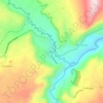
Name: Cubijíes topographic map, elevation, terrain.
Location: Cubijíes, Riobamba, Chimborazo, Ecuador (-1.66448 -78.60798 -1.62448 -78.56798)
Average elevation: 8,615 ft
Minimum elevation: 7,989 ft
Maximum elevation: 9,442 ft
Thank you for supporting this site ❤️
Make a donation
Make a donation
Gear up for your next adventure:
As an Amazon Associate, this site earns from qualifying purchases at no extra cost to you.