
Make a donation
Gear up for your next adventure:
As an Amazon Associate, this site earns from qualifying purchases at no extra cost to you.
Lake Lure topographic map
Click on the map to display elevation.
Make a donation
Gear up for your next adventure:
As an Amazon Associate, this site earns from qualifying purchases at no extra cost to you.
About this map
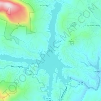
Name: Lake Lure topographic map, elevation, terrain.
Location: Lake Lure, Rutherford County, North Carolina, United States (35.41595 -82.23490 35.46091 -82.18222)
Average elevation: 1,230 ft
Minimum elevation: 869 ft
Maximum elevation: 2,864 ft
Rutherford County trails, hiking, mountain biking, running and outdoor activities
Make a donation
Gear up for your next adventure:
As an Amazon Associate, this site earns from qualifying purchases at no extra cost to you.
Other topographic maps
Click on a map to view its topography, its elevation and its terrain.
Deerfield
United States > North Carolina > Rutherford County > Lake Lure > Deerfield
Average elevation: 1,647 ft