
Thank you for supporting this site ❤️
Make a donation
Make a donation
Gear up for your next adventure:
As an Amazon Associate, this site earns from qualifying purchases at no extra cost to you.
Kuju topographic map
Click on the map to display elevation.
Thank you for supporting this site ❤️
Make a donation
Make a donation
Gear up for your next adventure:
As an Amazon Associate, this site earns from qualifying purchases at no extra cost to you.
About this map
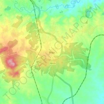
Name: Kuju topographic map, elevation, terrain.
Location: Kuju, Mandu, Ramgarh, Jharkhand, 825316, India (23.67892 85.47151 23.75892 85.55151)
Average elevation: 1,293 ft
Minimum elevation: 1,086 ft
Maximum elevation: 1,631 ft
Thank you for supporting this site ❤️
Make a donation
Make a donation
Gear up for your next adventure:
As an Amazon Associate, this site earns from qualifying purchases at no extra cost to you.