Geolocate

Moretz topographic map

Click on the map to display elevation.

About this map

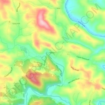
Name: Moretz topographic map, elevation, terrain.

Location: Moretz, Watauga County, North Carolina, United States (36.24513 -81.64038 36.28513 -81.60038)

Average elevation: 3,245 ft

Minimum elevation: 2,956 ft

Maximum elevation: 3,615 ft

Gear up for your next adventure:

🦺Reflective Outdoor Gear - Safety gear for low‑light conditions
👓Polarized Sunglasses - Outdoor sunglasses for glare reduction
🪶Multi‑Purpose Knife - Useful blade for camp and trail
🪶Camp Gear Gift Set - Perfect gift bundle for outdoor fans
🔥Fast-Boil Camping Stoves - Efficient cooking systems for quick trail meals

As an Amazon Associate, this site earns from qualifying purchases at no extra cost to you.