Geolocate

Sal topographic map

Click on the map to display elevation.

About this map

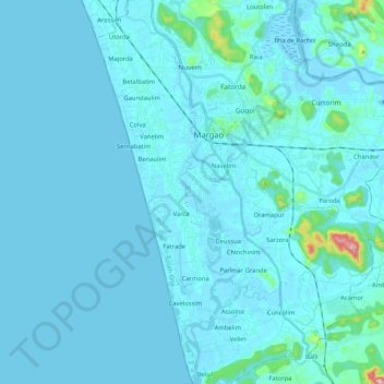
Name: Sal topographic map, elevation, terrain.

Location: Sal, Parlmar Grande, Salcete, South Goa, Goa, India (15.14200 73.94233 15.26186 73.97274)

Average elevation: 49 ft

Minimum elevation: -3 ft

Maximum elevation: 823 ft

Gear up for your next adventure:

🧯Emergency Survival Kit - All‑in‑one survival essentials for the backcountry
🪶Multi‑Purpose Knife - Useful blade for camp and trail
🧭Outdoor Navigation Book - Learn advanced navigation skills
🪶LED Camping Lantern - Bright lantern for camp lighting
🔌Solar Panel Charger - Charge gear sustainably outdoors

As an Amazon Associate, this site earns from qualifying purchases at no extra cost to you.