
Morning Star topographic map
Click on the map to display elevation.
About this map
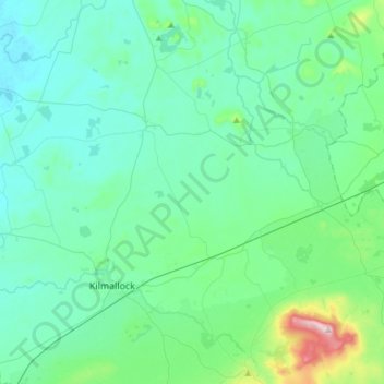
Name: Morning Star topographic map, elevation, terrain.
Location: Morning Star, County Limerick, Munster, V35 YW50, Ireland (52.40470 -8.68070 52.48345 -8.37865)
Average elevation: 322 ft
Minimum elevation: 118 ft
Maximum elevation: 1,476 ft
Other topographic maps
Click on a map to view its topography, its elevation and its terrain.
Bruree
Ireland > County Limerick > The Municipal District of Cappamore — Kilmallock
Average elevation: 203 ft