
Thank you for supporting this site ❤️
Make a donation
Make a donation
Gear up for your next adventure:
As an Amazon Associate, this site earns from qualifying purchases at no extra cost to you.
Aragatsotn topographic map
Click on the map to display elevation.
Thank you for supporting this site ❤️
Make a donation
Make a donation
Gear up for your next adventure:
As an Amazon Associate, this site earns from qualifying purchases at no extra cost to you.
About this map
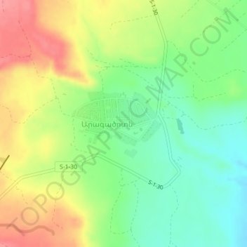
Name: Aragatsotn topographic map, elevation, terrain.
Location: Aragatsotn, Ashtarak region, Aragatsotn Province, Armenia (40.25403 44.17457 40.26205 44.18848)
Average elevation: 3,533 ft
Minimum elevation: 3,402 ft
Maximum elevation: 3,698 ft
Thank you for supporting this site ❤️
Make a donation
Make a donation
Gear up for your next adventure:
As an Amazon Associate, this site earns from qualifying purchases at no extra cost to you.