Geolocate

Highland topographic map

Click on the map to display elevation.

About this map

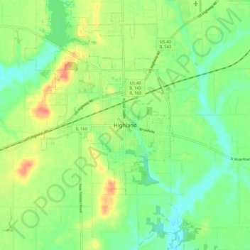
Name: Highland topographic map, elevation, terrain.

Location: Highland, Madison County, Illinois, 62249, United States (38.69949 -89.71120 38.77949 -89.63120)

Average elevation: 528 ft

Minimum elevation: 459 ft

Maximum elevation: 630 ft

Madison County trails, hiking, mountain biking, running and outdoor activities

Gear up for your next adventure:

🌧️Backpack Rain Cover - Keep gear dry in wet weather
🛡️Bear Spray Outdoor - Protection in bear country hikes
🥤Water Filter Bottle - All‑in‑one filter bottle for safe hydration
🔌Solar Panel Charger - Charge gear sustainably outdoors
📻Weather Alert Radios - Stay informed of storm risks while off-the-grid

As an Amazon Associate, this site earns from qualifying purchases at no extra cost to you.