Geolocate

Mexico topographic map

Click on the map to display elevation.

About this map

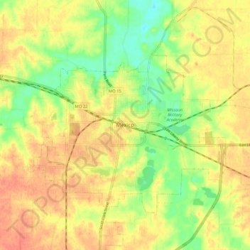
Name: Mexico topographic map, elevation, terrain.

Location: Mexico, Audrain County, Missouri, 65265, United States (39.12976 -91.92295 39.20976 -91.84295)

Average elevation: 794 ft

Minimum elevation: 709 ft

Maximum elevation: 850 ft

Audrain County trails, hiking, mountain biking, running and outdoor activities

Gear up for your next adventure:

🧥Men's Rain Shells - Premium waterproof and breathable jackets for mountain weather
🪵Folding Camp Saw - Compact saw for wood and campsite work
☀️Outdoor Sunscreen - High protection sunscreen for outdoor activities
📶Vehicle Signal Boosters - Improve reception in rural areas while driving to trailheads
🧯Portable Fire Pit - Compact fire pit for camping spots

As an Amazon Associate, this site earns from qualifying purchases at no extra cost to you.