Geolocate

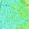
San Isidro topographic map

Click on the map to display elevation.

About this map

Name: San Isidro topographic map, elevation, terrain.

Location: San Isidro, Parañaque District 1, Parañaque, Southern Manila District, Metro Manila, Philippines (14.45523 120.99893 14.47749 121.02036)

Average elevation: 49 ft

Minimum elevation: 20 ft

Maximum elevation: 79 ft

Other topographic maps

Click on a map to view its topography, its elevation and its terrain.
Baltao Subdivision

Philippines > Parañaque

Average elevation: 30 ft

Gear up for your next adventure:

🧯Portable Fire Pit - Compact fire pit for camping spots
🏫Relief Map Kits - Hands-on tools for teaching landforms and elevation
🔋Solar Power Banks - Keep your GPS and phone charged in remote wilderness areas
🧢Sun Protection Hats - Wide-brimmed and UPF-rated hats for high-altitude sun safety
📌Outdoor GPS Map App - Apps and devices for digital topographic navigation

As an Amazon Associate, this site earns from qualifying purchases at no extra cost to you.