Geolocate

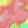
Talatuoya topographic map

Click on the map to display elevation.

About this map

Name: Talatuoya topographic map, elevation, terrain.

Location: Talatuoya, Kandy District, Central Province, 20168, Sri Lanka (7.21151 80.65036 7.29151 80.73036)

Average elevation: 1,998 ft

Minimum elevation: 1,378 ft

Maximum elevation: 3,878 ft

Other topographic maps

Click on a map to view its topography, its elevation and its terrain.
Kandy District

Sri Lanka > Central Province

Average elevation: 2,405 ft

Horton Plains National Park

Sri Lanka > Central Province > Nuwara Eliya

Horton Plains National Park (Sinhala: හෝර්ටන් තැන්න ජාතික උද්‍යානය, romanized: Hortan Thanna Jathika Udyanaya) is a national park in the central highlands of Sri Lanka that was designated in 1988. It encompasses an area of 31 km2 (12 sq mi) and borders…

Average elevation: 6,594 ft
Matale District

Sri Lanka > Central Province

Average elevation: 886 ft

Nuwara Eliya District

Sri Lanka > Central Province

Average elevation: 3,586 ft

Kandy District

Sri Lanka > Central Province

Average elevation: 2,405 ft

Matale District

Sri Lanka > Central Province

Average elevation: 886 ft

Sigiriya

Sri Lanka > Central Province

Average elevation: 666 ft

Matale District

Sri Lanka > Central Province

Average elevation: 886 ft

Nanu Oya

Sri Lanka > Central Province > Nanu Oya

Average elevation: 5,869 ft

Nuwara Eliya District

Sri Lanka > Central Province

Average elevation: 3,586 ft

Horton Plains National Park

Sri Lanka > Central Province

Horton Plains National Park (Sinhala: හෝර්ටන් තැන්න ජාතික උද්‍යානය, romanized: Hortan Thanna Jathika Udyanaya) is a national park in the central highlands of Sri Lanka that was designated in 1988. It is located at an elevation of 2,100–2,300 m (6,900–7,500…

Average elevation: 6,594 ft

Kandy District

Sri Lanka > Central Province

Average elevation: 2,405 ft

Horton Plains National Park

Sri Lanka > Central Province

Horton Plains National Park (Sinhala: හෝර්ටන් තැන්න ජාතික උද්‍යානය, romanized: Hortan Thanna Jathika Udyanaya) is a national park in the central highlands of Sri Lanka that was designated in 1988. It covers an area of 31km² and borders Thotupalakanda Nature…

Average elevation: 6,594 ft
Matale District

Sri Lanka > Central Province

Average elevation: 886 ft

Upper Kotmale Dam

Sri Lanka > Central Province > Talawakele > Holyrood

Average elevation: 4,098 ft

Gear up for your next adventure:

🧴Hand Sanitizer - Keep hands clean while hiking
🧣Hiking Neck Gaiter - Multi‑use neck protection for outdoor weather
🧭GPS Watch Accessories - Bands and chargers for GPS watches
🥄Camping Utensil Set - Lightweight utensils for outdoor meals
🪄Magnetic Compass - Accurate compass for navigation

As an Amazon Associate, this site earns from qualifying purchases at no extra cost to you.