
Thank you for supporting this site ❤️
Make a donation
Make a donation
Gear up for your next adventure:
As an Amazon Associate, this site earns from qualifying purchases at no extra cost to you.
Tanjungarum topographic map
Click on the map to display elevation.
Thank you for supporting this site ❤️
Make a donation
Make a donation
Gear up for your next adventure:
As an Amazon Associate, this site earns from qualifying purchases at no extra cost to you.
About this map
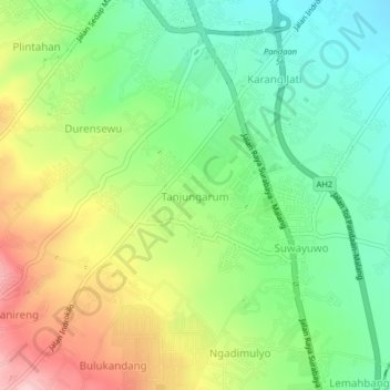
Name: Tanjungarum topographic map, elevation, terrain.
Location: Tanjungarum, Pasuruan, East Java, 67161, Indonesia (-7.70233 112.67892 -7.66233 112.71892)
Average elevation: 751 ft
Minimum elevation: 472 ft
Maximum elevation: 1,175 ft
Thank you for supporting this site ❤️
Make a donation
Make a donation
Gear up for your next adventure:
As an Amazon Associate, this site earns from qualifying purchases at no extra cost to you.