
Thank you for supporting this site ❤️
Make a donation
Make a donation
Gear up for your next adventure:
As an Amazon Associate, this site earns from qualifying purchases at no extra cost to you.
Merli topographic map
Click on the map to display elevation.
Thank you for supporting this site ❤️
Make a donation
Make a donation
Gear up for your next adventure:
As an Amazon Associate, this site earns from qualifying purchases at no extra cost to you.
About this map
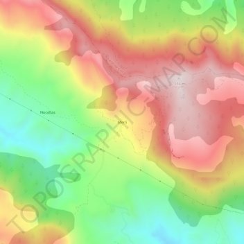
Name: Merli topographic map, elevation, terrain.
Location: Merli, Nocellas, Isábena, La Ribagorza, Huesca, Aragón, Spanje (42.32192 0.46509 42.36192 0.50509)
Average elevation: 3,986 ft
Minimum elevation: 2,864 ft
Maximum elevation: 5,069 ft
Thank you for supporting this site ❤️
Make a donation
Make a donation
Gear up for your next adventure:
As an Amazon Associate, this site earns from qualifying purchases at no extra cost to you.