Geolocate

Tarimi topographic map

Click on the map to display elevation.

About this map

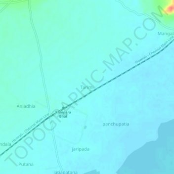
Name: Tarimi topographic map, elevation, terrain.

Location: Tarimi, Tangi, Khordha, Odisha, 752022, India (19.88182 85.38925 19.92182 85.42925)

Average elevation: 23 ft

Minimum elevation: 3 ft

Maximum elevation: 187 ft

Gear up for your next adventure:

🪶LED Camping Lantern - Bright lantern for camp lighting
🛌Ultralight Sleeping Bags - Compact down bags for cold nights in the wilderness
🔌USB Car Charger - Car charger for on‑the‑go power needs
🏫Relief Map Kits - Hands-on tools for teaching landforms and elevation
🧯Portable Fire Pit - Compact fire pit for camping spots

As an Amazon Associate, this site earns from qualifying purchases at no extra cost to you.