Geolocate

High Park topographic map

Click on the map to display elevation.

About this map

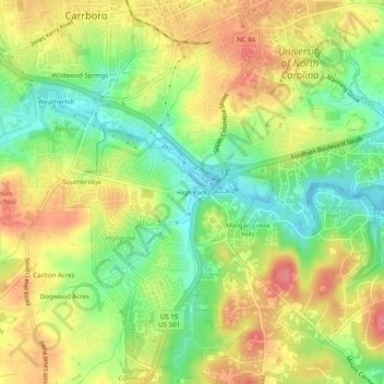
Name: High Park topographic map, elevation, terrain.

Location: High Park, Chapel Hill, Orange County, North Carolina, 27599, United States (35.87153 -79.08168 35.91153 -79.04168)

Average elevation: 420 ft

Minimum elevation: 289 ft

Maximum elevation: 551 ft

Orange County trails, hiking, mountain biking, running and outdoor activities

Other topographic maps

Click on a map to view its topography, its elevation and its terrain.

Gear up for your next adventure:

Solar GPS Watches - Advanced multisport watches with built-in topographic maps
🚑Emergency Bivvies - Heat-reflective sleeping bags for survival situations
🧭Compass with Lanyard - Easy‑carry compass for navigation
🥄Camping Utensil Set - Lightweight utensils for outdoor meals
🛰️Handheld GPS Units - Professional satellite navigators for precise backcountry mapping

As an Amazon Associate, this site earns from qualifying purchases at no extra cost to you.