Geolocate

Avadi topographic map

Click on the map to display elevation.

Avadi

Avadi is located at 13°07′N 80°06′E / 13.12°N 80.1°E / 13.12; 80.1. It covers an area of 65 square kilometres (25 sq mi) and has an average elevation of 17 metres (56 ft).

Wikipedia (CC-BY-SA 3.0)

About this map

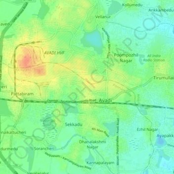
Name: Avadi topographic map, elevation, terrain.

Location: Avadi, Poonamallee, Thiruvallur District, Tamil Nadu, 600054, India (12.95948 79.94267 13.27948 80.26267)

Average elevation: 75 ft

Minimum elevation: -3 ft

Maximum elevation: 449 ft

Gear up for your next adventure:

🗃️Trail First Aid Kit - Essential kit for outdoor injuries and emergencies
🧦Hiking Socks - Comfortable socks to prevent blisters on long hikes
🪶Multi‑Purpose Knife - Useful blade for camp and trail
🪶Compact Camp Shovel - Folding shovel for campsite tasks
🎒Waterproof Dry Bags - Keep your electronics and maps dry inside your pack

As an Amazon Associate, this site earns from qualifying purchases at no extra cost to you.