
Marcus Hook topographic map
Click on the map to display elevation.
About this map
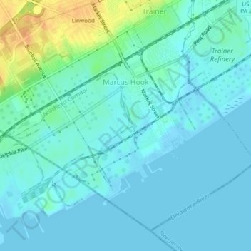
Name: Marcus Hook topographic map, elevation, terrain.
Location: Marcus Hook, Delaware County, Pennsylvania, United States (39.80231 -75.43679 39.82649 -75.39917)
Average elevation: 26 ft
Minimum elevation: -13 ft
Maximum elevation: 121 ft
Delaware County trails, hiking, mountain biking, running and outdoor activities
Other topographic maps
Click on a map to view its topography, its elevation and its terrain.