Geolocate

Bayshore Commons topographic map

Click on the map to display elevation.

About this map

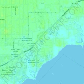
Name: Bayshore Commons topographic map, elevation, terrain.

Location: Bayshore Commons, Lee County, Florida, 33917, United States (26.67496 -81.87175 26.71496 -81.83175)

Average elevation: 13 ft

Minimum elevation: 0 ft

Maximum elevation: 30 ft

Gear up for your next adventure:

💧Water Filtration Bottles - Safely drink from streams and lakes while exploring
🌡️Portable Weather Meter - Track weather conditions on the trail
📌Outdoor GPS Map App - Apps and devices for digital topographic navigation
🧯Portable Fire Pit - Compact fire pit for camping spots
📻Weather Alert Radios - Stay informed of storm risks while off-the-grid

As an Amazon Associate, this site earns from qualifying purchases at no extra cost to you.