
Sahaspur topographic map
Click on the map to display elevation.
Sahaspur
Sahaspur is located at 29°07′16″N 78°37′16″E / 29.121°N 78.621°E / 29.121; 78.621. It has an average elevation of 199 metres (653 feet).
About this map
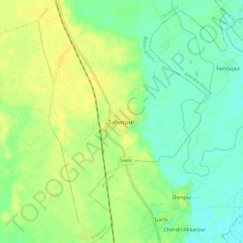
Name: Sahaspur topographic map, elevation, terrain.
Location: Sahaspur, Dhampur, Bijnor, Uttar Pradesh, 246745, India (29.08119 78.58089 29.16119 78.66089)
Average elevation: 712 ft
Minimum elevation: 676 ft
Maximum elevation: 745 ft