
Thank you for supporting this site ❤️
Make a donation
Make a donation
Gear up for your next adventure:
As an Amazon Associate, this site earns from qualifying purchases at no extra cost to you.
Lindavista topographic map
Click on the map to display elevation.
Thank you for supporting this site ❤️
Make a donation
Make a donation
Gear up for your next adventure:
As an Amazon Associate, this site earns from qualifying purchases at no extra cost to you.
About this map
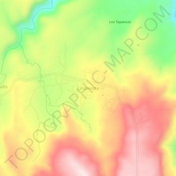
Name: Lindavista topographic map, elevation, terrain.
Location: Lindavista, Del Nayar, Nayarit, México (22.37345 -104.84386 22.41345 -104.80386)
Average elevation: 7,218 ft
Minimum elevation: 6,467 ft
Maximum elevation: 7,825 ft
Thank you for supporting this site ❤️
Make a donation
Make a donation
Gear up for your next adventure:
As an Amazon Associate, this site earns from qualifying purchases at no extra cost to you.