Geolocate

Colorado City topographic map

Click on the map to display elevation.

About this map

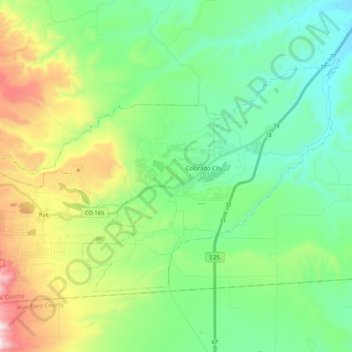
Name: Colorado City topographic map, elevation, terrain.

Location: Colorado City, Pueblo County, Colorado, 81019, United States (37.88732 -104.96318 37.99585 -104.75477)

Average elevation: 6,122 ft

Minimum elevation: 5,305 ft

Maximum elevation: 7,487 ft

Pueblo County trails, hiking, mountain biking, running and outdoor activities

Gear up for your next adventure:

🌡️Portable Weather Meter - Track weather conditions on the trail
🛶Inflatable Kayak - Portable kayak for rivers, lakes, and expeditions
🧭GPS Watch Accessories - Bands and chargers for GPS watches
📷Action Camera - Capture your outdoor adventures in HD
🔌Solar Panel Charger - Charge gear sustainably outdoors

As an Amazon Associate, this site earns from qualifying purchases at no extra cost to you.