
Cunit topographic map
Interactive map
Click on the map to display elevation.
About this map
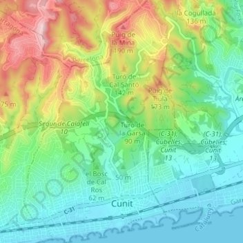
Name: Cunit topographic map, elevation, terrain.
Location: Cunit, Baix Penedès, Tarragona, Catalonië, 43881, Spanje (41.19003 1.60953 41.23637 1.65309)
Average elevation: 233 ft
Minimum elevation: -10 ft
Maximum elevation: 722 ft
Other topographic maps
Click on a map to view its topography, its elevation and its terrain.
Calafell
Spanje > Catalonië > Baix Penedès
Calafell, Baix Penedès, Tarragona, Catalonië, 43882, Spanje
Average elevation: 207 ft