
Calafell topographic map
Interactive map
Click on the map to display elevation.
About this map
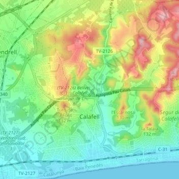
Name: Calafell topographic map, elevation, terrain.
Location: Calafell, Baix Penedès, Tarragona, Catalonië, 43882, Spanje (41.18364 1.55732 41.23482 1.62141)
Average elevation: 207 ft
Minimum elevation: 0 ft
Maximum elevation: 581 ft
Other topographic maps
Click on a map to view its topography, its elevation and its terrain.
Cunit
Spanje > Catalonië > Baix Penedès
Cunit, Baix Penedès, Tarragona, Catalonië, 43881, Spanje
Average elevation: 233 ft