
Trinity River topographic map
Click on the map to display elevation.
About this map
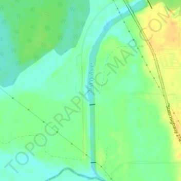
Name: Trinity River topographic map, elevation, terrain.
Location: Trinity River, Tool, Henderson County, Texas, United States (32.21344 -96.15145 32.23979 -96.14145)
Average elevation: 302 ft
Minimum elevation: 262 ft
Maximum elevation: 358 ft
Henderson County trails, hiking, mountain biking, running and outdoor activities