
Thank you for supporting this site ❤️
Make a donation
Make a donation
Gear up for your next adventure:
As an Amazon Associate, this site earns from qualifying purchases at no extra cost to you.
Agri topographic map
Click on the map to display elevation.
Thank you for supporting this site ❤️
Make a donation
Make a donation
Gear up for your next adventure:
As an Amazon Associate, this site earns from qualifying purchases at no extra cost to you.
About this map
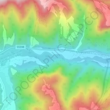
Name: Agri topographic map, elevation, terrain.
Location: Agri, San Martino d'Agri, Potenza, Basilicata, Italy (40.25986 16.11156 40.26326 16.13298)
Average elevation: 1,611 ft
Minimum elevation: 1,017 ft
Maximum elevation: 2,575 ft
Thank you for supporting this site ❤️
Make a donation
Make a donation
Gear up for your next adventure:
As an Amazon Associate, this site earns from qualifying purchases at no extra cost to you.