
Verkeerdevlei topographic map
Click on the map to display elevation.
About this map
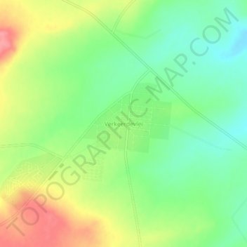
Name: Verkeerdevlei topographic map, elevation, terrain.
Average elevation: 4,836 ft
Minimum elevation: 4,715 ft
Maximum elevation: 5,003 ft
Other topographic maps
Click on a map to view its topography, its elevation and its terrain.
Masilonyana Ward 3
South Africa > Free State > Lejweleputswa District Municipality > Masilonyana Local Municipality
Average elevation: 4,656 ft
HJ Joel Nature Reserve
South Africa > Free State > Lejweleputswa District Municipality > Masilonyana Local Municipality
Average elevation: 4,547 ft
Erfenis Dam
South Africa > Free State > Lejweleputswa District Municipality > Masilonyana Local Municipality
Average elevation: 4,449 ft
Masilonyana Ward 2
South Africa > Free State > Lejweleputswa District Municipality > Masilonyana Local Municipality
Average elevation: 4,370 ft