Geolocate

Paulden topographic map

Click on the map to display elevation.

About this map

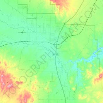
Name: Paulden topographic map, elevation, terrain.

Location: Paulden, Yavapai County, Arizona, United States (34.80443 -112.59416 34.95530 -112.39869)

Average elevation: 4,619 ft

Minimum elevation: 4,190 ft

Maximum elevation: 5,705 ft

Yavapai County trails, hiking, mountain biking, running and outdoor activities

Gear up for your next adventure:

🚑Emergency Bivvies - Heat-reflective sleeping bags for survival situations
🥄Camping Utensil Set - Lightweight utensils for outdoor meals
🔥Fast-Boil Camping Stoves - Efficient cooking systems for quick trail meals
🧥Men's Rain Shells - Premium waterproof and breathable jackets for mountain weather
🌡️Handheld Weather Meters - Measure wind, temp, and pressure for safe mountain travel

As an Amazon Associate, this site earns from qualifying purchases at no extra cost to you.