Geolocate

Ensley topographic map

Click on the map to display elevation.

About this map

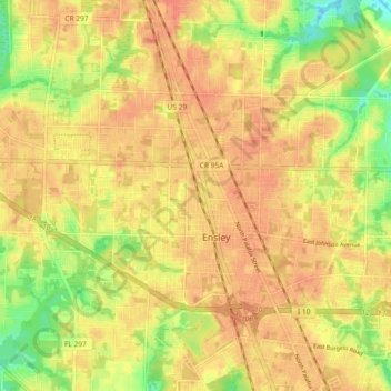
Name: Ensley topographic map, elevation, terrain.

Location: Ensley, Escambia County, Florida, 32534, United States (30.50335 -87.31346 30.55101 -87.22146)

Average elevation: 115 ft

Minimum elevation: 20 ft

Maximum elevation: 161 ft

Escambia County trails, hiking, mountain biking, running and outdoor activities

Gear up for your next adventure:

🚁Photography Drones - Capture stunning aerial views of landforms and topography
🧤Hiking Gloves - Protective gloves for rugged trails
🪶Wildlife Field Guides - Learn animal tracking and species ID
🔭Stargazing Telescopes - Perfect for camping in low-light pollution areas shown on maps
🧥Men's Rain Shells - Premium waterproof and breathable jackets for mountain weather

As an Amazon Associate, this site earns from qualifying purchases at no extra cost to you.