
Thank you for supporting this site ❤️
Make a donation
Make a donation
Gear up for your next adventure:
As an Amazon Associate, this site earns from qualifying purchases at no extra cost to you.
Beowawe topographic map
Click on the map to display elevation.
Thank you for supporting this site ❤️
Make a donation
Make a donation
Gear up for your next adventure:
As an Amazon Associate, this site earns from qualifying purchases at no extra cost to you.
About this map
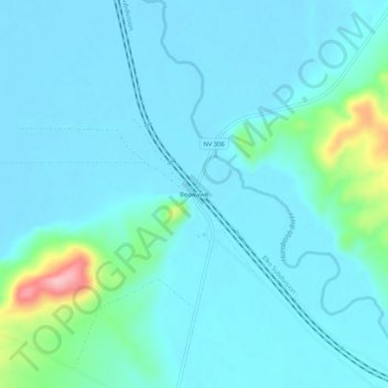
Name: Beowawe topographic map, elevation, terrain.
Location: Beowawe, Eureka County, Nevada, États-Unis d'Amérique (40.57306 -116.49800 40.61306 -116.45800)
Average elevation: 4,757 ft
Minimum elevation: 4,685 ft
Maximum elevation: 5,220 ft
Thank you for supporting this site ❤️
Make a donation
Make a donation
Gear up for your next adventure:
As an Amazon Associate, this site earns from qualifying purchases at no extra cost to you.