
Thank you for supporting this site ❤️
Make a donation
Make a donation
Gear up for your next adventure:
As an Amazon Associate, this site earns from qualifying purchases at no extra cost to you.
Chimbi topographic map
Click on the map to display elevation.
Thank you for supporting this site ❤️
Make a donation
Make a donation
Gear up for your next adventure:
As an Amazon Associate, this site earns from qualifying purchases at no extra cost to you.
About this map
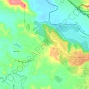
Name: Chimbi topographic map, elevation, terrain.
Location: Chimbi, Melgar, Oriente, Tolima, Región Andina, Colombia (4.18310 -74.72633 4.22310 -74.68633)
Average elevation: 997 ft
Minimum elevation: 896 ft
Maximum elevation: 1,207 ft
Thank you for supporting this site ❤️
Make a donation
Make a donation
Gear up for your next adventure:
As an Amazon Associate, this site earns from qualifying purchases at no extra cost to you.