
Thank you for supporting this site ❤️
Make a donation
Make a donation
Gear up for your next adventure:
As an Amazon Associate, this site earns from qualifying purchases at no extra cost to you.
Tordelloso topographic map
Click on the map to display elevation.
Thank you for supporting this site ❤️
Make a donation
Make a donation
Gear up for your next adventure:
As an Amazon Associate, this site earns from qualifying purchases at no extra cost to you.
About this map
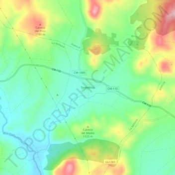
Name: Tordelloso topographic map, elevation, terrain.
Location: Tordelloso, La Miñosa, Guadalajara, Castilla-La Mancha, España (41.18618 -2.93976 41.22618 -2.89976)
Average elevation: 3,566 ft
Minimum elevation: 3,323 ft
Maximum elevation: 4,009 ft
Thank you for supporting this site ❤️
Make a donation
Make a donation
Gear up for your next adventure:
As an Amazon Associate, this site earns from qualifying purchases at no extra cost to you.