Geolocate

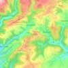
Brecht topographic map

Click on the map to display elevation.

About this map

Name: Brecht topographic map, elevation, terrain.

Location: Brecht, Bitburger Land, Eifelkreis Bitburg-Prüm, Rijnland-Palts, Duitsland (49.96863 6.41088 50.00532 6.46556)

Average elevation: 1,017 ft

Minimum elevation: 722 ft

Maximum elevation: 1,447 ft

Other topographic maps

Click on a map to view its topography, its elevation and its terrain.

Buscht

Duitsland > Rijnland-Palts > Eifelkreis Bitburg-Prüm

Average elevation: 1,234 ft

Gear up for your next adventure:

🦶Hiking Gaiters - Keep debris and water out of your boots
🌧️Backpack Rain Cover - Keep gear dry in wet weather
🥾Hiking Shoes - Durable and comfortable shoes for trail hiking
🥤Water Filter Bottle - All‑in‑one filter bottle for safe hydration
🪶Paracord Bracelet - Survival bracelet with built‑in tools

As an Amazon Associate, this site earns from qualifying purchases at no extra cost to you.