Geolocate

Tiracol topographic map

Click on the map to display elevation.

About this map

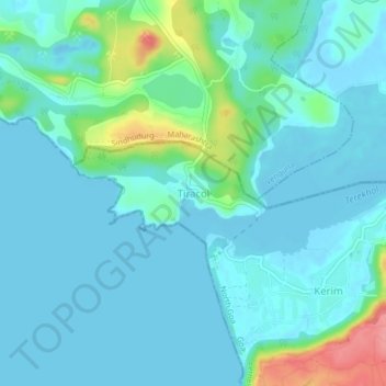
Name: Tiracol topographic map, elevation, terrain.

Location: Tiracol, Pernem, North Goa District, Goa, 416517, India (15.70410 73.66873 15.74410 73.70873)

Average elevation: 52 ft

Minimum elevation: -10 ft

Maximum elevation: 299 ft

Other topographic maps

Click on a map to view its topography, its elevation and its terrain.

Morjim Beach

India > Goa > Pernem

Average elevation: 10 ft

Arambol Sweet Water Lake

India > Goa > Pernem > Arambol

Average elevation: 82 ft

Gear up for your next adventure:

Solar GPS Watches - Advanced multisport watches with built-in topographic maps
🥾Women's Hiking Boots - Top-rated trail boots with ankle support and superior grip
🔥Fast-Boil Camping Stoves - Efficient cooking systems for quick trail meals
🎒Waterproof Dry Bags - Keep your electronics and maps dry inside your pack
🌡️Handheld Weather Meters - Measure wind, temp, and pressure for safe mountain travel

As an Amazon Associate, this site earns from qualifying purchases at no extra cost to you.