Geolocate

Velebit topographic map

Click on the map to display elevation.

About this map

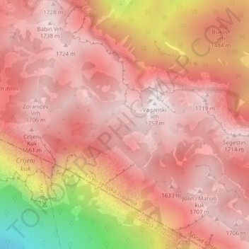
Name: Velebit topographic map, elevation, terrain.

Location: Velebit, Grad Gospić, Lika-Senj County, Croatia (44.36495 15.49995 44.36505 15.50005)

Average elevation: 4,741 ft

Minimum elevation: 2,037 ft

Maximum elevation: 5,745 ft

Other topographic maps

Click on a map to view its topography, its elevation and its terrain.

Kukljić

Croatia > Lika-Senj County > Grad Gospić

Average elevation: 3,156 ft

Gear up for your next adventure:

📚Navigation Handbooks - Master the art of reading topographic maps and using a compass
🏔️Mountain Trail Maps - High‑detail maps for popular peaks
🗺️Topographic Maps - Detailed topo maps for hiking, exploring and outdoor navigation
🚪Portable Camp Chair - Foldable chair for comfort at camp
🎒Hydration Pack - Hands‑free water reservoir for long hikes

As an Amazon Associate, this site earns from qualifying purchases at no extra cost to you.