Geolocate

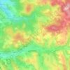
46300 topographic map

Click on the map to display elevation.

About this map

Name: 46300 topographic map, elevation, terrain.

Location: 46300, Le Vigan-en-Quercy, Gourdon, Lot, Occitanie, France métropolitaine, France (44.67758 1.28711 44.82561 1.55991)

Average elevation: 748 ft

Minimum elevation: 240 ft

Maximum elevation: 1,457 ft

Other topographic maps

Click on a map to view its topography, its elevation and its terrain.
Tauty

France > Occitanie > Lot > Le Vigan-en-Quercy

Average elevation: 850 ft

Le Plantou

France > Occitanie > Lot > Le Vigan-en-Quercy

Average elevation: 873 ft

Gear up for your next adventure:

☀️Outdoor Sunscreen - High protection sunscreen for outdoor activities
🎁Geography Themed Gifts - Unique gift ideas for map lovers and geography enthusiasts
🪶Paracord Bracelet - Survival bracelet with built‑in tools
🚗GPS Dash Cams - Record your scenic drives through mountain passes and canyons
🚁Photography Drones - Capture stunning aerial views of landforms and topography

As an Amazon Associate, this site earns from qualifying purchases at no extra cost to you.