Geolocate

Five Forks topographic map

Click on the map to display elevation.

About this map

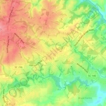
Name: Five Forks topographic map, elevation, terrain.

Location: Five Forks, Greenville County, South Carolina, United States (34.78617 -82.25911 34.83001 -82.18565)

Average elevation: 833 ft

Minimum elevation: 682 ft

Maximum elevation: 974 ft

Greenville County trails, hiking, mountain biking, running and outdoor activities

Gear up for your next adventure:

Backpacking Tent - Lightweight and durable tent for multi‑day hikes
🧼Biodegradable Camping Soap - Eco‑friendly soap for outdoor hygiene
💧Water Purification System - Clean water on the trail with reliable purifiers
🪶LED Camping Lantern - Bright lantern for camp lighting
🌧️Backpack Rain Cover - Keep gear dry in wet weather

As an Amazon Associate, this site earns from qualifying purchases at no extra cost to you.