Geolocate

Blythe topographic map

Click on the map to display elevation.

About this map

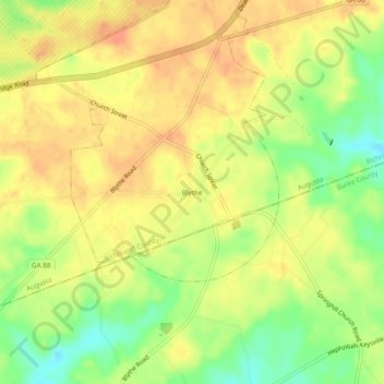
Name: Blythe topographic map, elevation, terrain.

Location: Blythe, Richmond County, Georgia, 30805, United States (33.27264 -82.22151 33.31264 -82.18151)

Average elevation: 440 ft

Minimum elevation: 354 ft

Maximum elevation: 492 ft

Richmond County trails, hiking, mountain biking, running and outdoor activities

Gear up for your next adventure:

📡GPS Antenna Upgrade - Enhance GPS reception in remote terrain
🧼Biodegradable Camping Soap - Eco‑friendly soap for outdoor hygiene
🪄Magnetic Compass - Accurate compass for navigation
🪵Folding Camp Saw - Compact saw for wood and campsite work
👟Trail Running Shoes - Lightweight shoes for trail runners

As an Amazon Associate, this site earns from qualifying purchases at no extra cost to you.