
Thank you for supporting this site ❤️
Make a donation
Make a donation
Gear up for your next adventure:
As an Amazon Associate, this site earns from qualifying purchases at no extra cost to you.
Al Jumum topographic map
Click on the map to display elevation.
Thank you for supporting this site ❤️
Make a donation
Make a donation
Gear up for your next adventure:
As an Amazon Associate, this site earns from qualifying purchases at no extra cost to you.
About this map
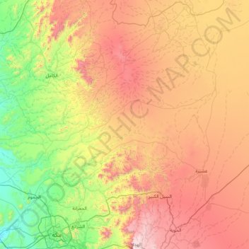
Name: Al Jumum topographic map, elevation, terrain.
Location: Al Jumum, Makkah Region, 10928, Saudi Arabia (21.46221 39.20483 22.53537 40.62057)
Average elevation: 2,877 ft
Minimum elevation: 325 ft
Maximum elevation: 7,113 ft
Thank you for supporting this site ❤️
Make a donation
Make a donation
Gear up for your next adventure:
As an Amazon Associate, this site earns from qualifying purchases at no extra cost to you.