Geolocate

Rizal topographic map

Click on the map to display elevation.

About this map

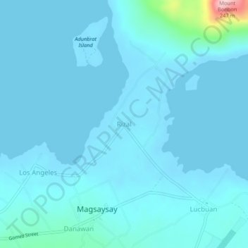
Name: Rizal topographic map, elevation, terrain.

Location: Rizal, Magsaysay, Palawan, Mimaropa, 5319, Philippines (10.85893 121.03420 10.89893 121.07420)

Average elevation: 56 ft

Minimum elevation: -13 ft

Maximum elevation: 797 ft

Gear up for your next adventure:

🌡️Handheld Weather Meters - Measure wind, temp, and pressure for safe mountain travel
🛠️Backpacking Tool Kit - Essential toolkit for outdoor repairs
🪑Portable Camp Table - Compact table for campsite meals
🪶Camping Sleeping Pad - Comfortable sleeping pad for backpacking
📡GPS Antenna Upgrade - Enhance GPS reception in remote terrain

As an Amazon Associate, this site earns from qualifying purchases at no extra cost to you.