
Thank you for supporting this site ❤️
Make a donation
Make a donation
Gear up for your next adventure:
As an Amazon Associate, this site earns from qualifying purchases at no extra cost to you.
Ssangji-ri topographic map
Click on the map to display elevation.
Thank you for supporting this site ❤️
Make a donation
Make a donation
Gear up for your next adventure:
As an Amazon Associate, this site earns from qualifying purchases at no extra cost to you.
About this map
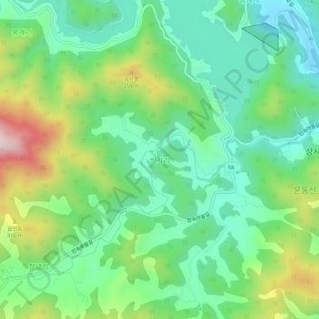
Name: Ssangji-ri topographic map, elevation, terrain.
Location: Ssangji-ri, Suncheon-si, South Jeolla, 57919, South Korea (34.91358 127.38302 34.95358 127.42302)
Average elevation: 591 ft
Minimum elevation: 85 ft
Maximum elevation: 1,663 ft
Thank you for supporting this site ❤️
Make a donation
Make a donation
Gear up for your next adventure:
As an Amazon Associate, this site earns from qualifying purchases at no extra cost to you.