Geolocate

Diavolitsi topographic map

Interactive map

Click on the map to display elevation.

About this map

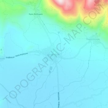
Name: Diavolitsi topographic map, elevation, terrain.

Location: Diavolitsi, Municipality of Oichalia, Messenia Regional Unit, Peloponnese Region, Peloponnese, Western Greece and the Ionian, 240 08, Greece (37.27983 21.94897 37.31983 21.98897)

Average elevation: 515 ft

Minimum elevation: 246 ft

Maximum elevation: 2,146 ft

Other topographic maps

Click on a map to view its topography, its elevation and its terrain.

Stoupa

Greece > Peloponnese, Western Greece and the Ionian > Messenia Regional Unit > Municipal Unit of Lefktro

Stoupa, Municipal Unit of Lefktro, Municipality of West Mani, Messenia Regional Unit, Peloponnese Region, Peloponnese, Western Greece and the Ionian, 240 24, Greece

Average elevation: 207 ft

Voreio

Greece > Peloponnese, Western Greece and the Ionian > Messenia Regional Unit > Municipal Unit of Avia

Voreio, Municipal Unit of Avia, Municipality of West Mani, Messenia Regional Unit, Peloponnese Region, Peloponnese, Western Greece and the Ionian, 240 16, Greece

Average elevation: 2,192 ft

Palace of Nestor

Greece > Peloponnese, Western Greece and the Ionian > Messenia Regional Unit > Chora > Pisaski

Palace of Nestor, Old National Highway 9, Pisaski, Chora, Municipality of Pylos and Nestor, Messenia Regional Unit, Peloponnese Region, Peloponnese, Western Greece and the Ionian, 246 00, Greece

Average elevation: 479 ft

Municipality of Pylos and Nestor

Greece > Peloponnese, Western Greece and the Ionian > Messenia Regional Unit

Municipality of Pylos and Nestor, Messenia Regional Unit, Peloponnese Region, Peloponnese, Western Greece and the Ionian, Greece

Average elevation: 331 ft

Καλαμάκι

Greece > Peloponnese, Western Greece and the Ionian > Messenia Regional Unit

Καλαμάκι, Municipality of Pylos and Nestor, Messenia Regional Unit, Peloponnese Region, Peloponnese, Western Greece and the Ionian, Greece

Average elevation: 1,129 ft

Exochori

Greece > Peloponnese, Western Greece and the Ionian > Messenia Regional Unit > Municipal Unit of Lefktro

Exochori, Municipal Unit of Lefktro, Municipality of West Mani, Messenia Regional Unit, Peloponnese Region, Peloponnese, Western Greece and the Ionian, 240 22, Greece

Average elevation: 1,644 ft

Pylos

Greece > Peloponnese, Western Greece and the Ionian > Messenia Regional Unit

Pylos, Municipality of Pylos and Nestor, Messenia Regional Unit, Peloponnese Region, Peloponnese, Western Greece and the Ionian, 240 01, Greece

Average elevation: 259 ft

Κυπαρισσία

Greece > Peloponnese, Western Greece and the Ionian > Messenia Regional Unit > Kyparissia Municipal Unit > Κυπαρισσία

Κυπαρισσία, Kyparissia Municipal Unit, Municipality of Trifylia, Messenia Regional Unit, Peloponnese Region, Peloponnese, Western Greece and the Ionian, 24500, Greece

Average elevation: 499 ft

Municipality of Kalamata

Greece > Peloponnese, Western Greece and the Ionian > Messenia Regional Unit

Municipality of Kalamata, Messenia Regional Unit, Peloponnese Region, Peloponnese, Western Greece and the Ionian, Greece

Average elevation: 1,608 ft