
Thank you for supporting this site ❤️
Make a donation
Make a donation
Gear up for your next adventure:
As an Amazon Associate, this site earns from qualifying purchases at no extra cost to you.
Burete topographic map
Click on the map to display elevation.
Thank you for supporting this site ❤️
Make a donation
Make a donation
Gear up for your next adventure:
As an Amazon Associate, this site earns from qualifying purchases at no extra cost to you.
About this map
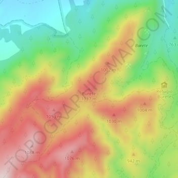
Name: Burete topographic map, elevation, terrain.
Location: Burete, Cehegín, Noroeste, Región de Murcia, España (38.02987 -1.77103 38.02997 -1.77093)
Average elevation: 2,920 ft
Minimum elevation: 2,234 ft
Maximum elevation: 3,625 ft
Thank you for supporting this site ❤️
Make a donation
Make a donation
Gear up for your next adventure:
As an Amazon Associate, this site earns from qualifying purchases at no extra cost to you.