Geolocate

Gunung Padang topographic map

Click on the map to display elevation.

About this map

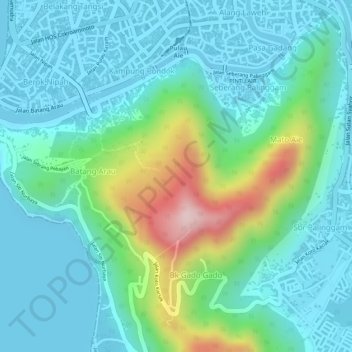
Name: Gunung Padang topographic map, elevation, terrain.

Location: Gunung Padang, Batang Arau, West Sumatra, 25119, Indonesia (-0.97101 100.36590 -0.97091 100.36600)

Average elevation: 236 ft

Minimum elevation: 0 ft

Maximum elevation: 997 ft

Gear up for your next adventure:

🥇GPS Hiking Watch - Multi‑sport GPS watch with navigation and trail tracking
🌡️Portable Weather Meter - Track weather conditions on the trail
👖Convertible Hiking Pants - Versatile zip-off pants for changing altitudes and temperatures
🩹Survival Bandages - High‑quality bandages for emergencies
🪶Multi‑Purpose Knife - Useful blade for camp and trail

As an Amazon Associate, this site earns from qualifying purchases at no extra cost to you.