
Georgia topographic map
Click on the map to display elevation.
About this map
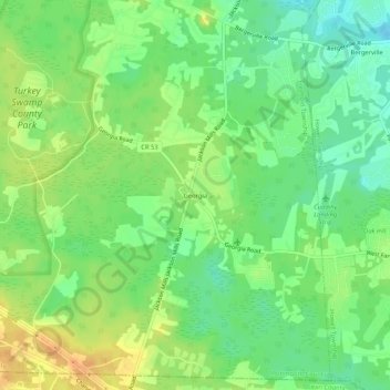
Name: Georgia topographic map, elevation, terrain.
Average elevation: 121 ft
Minimum elevation: 69 ft
Maximum elevation: 177 ft
Monmouth County trails, hiking, mountain biking, running and outdoor activities
Other topographic maps
Click on a map to view its topography, its elevation and its terrain.
West Freehold
United States > New Jersey > Monmouth County > Freehold Township
Average elevation: 141 ft
West Freehold
United States > New Jersey > Monmouth County > Freehold Township
Average elevation: 141 ft