
Thank you for supporting this site ❤️
Make a donation
Make a donation
Gear up for your next adventure:
As an Amazon Associate, this site earns from qualifying purchases at no extra cost to you.
Kümbet topographic map
Click on the map to display elevation.
Thank you for supporting this site ❤️
Make a donation
Make a donation
Gear up for your next adventure:
As an Amazon Associate, this site earns from qualifying purchases at no extra cost to you.
About this map
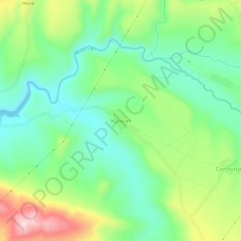
Name: Kümbet topographic map, elevation, terrain.
Location: Kümbet, Karakoçan, Elazığ, Eastern Anatolia Region, Turkey (38.86714 39.88773 38.90714 39.92773)
Average elevation: 3,287 ft
Minimum elevation: 2,959 ft
Maximum elevation: 3,914 ft
Thank you for supporting this site ❤️
Make a donation
Make a donation
Gear up for your next adventure:
As an Amazon Associate, this site earns from qualifying purchases at no extra cost to you.