
Thank you for supporting this site ❤️
Make a donation
Make a donation
Gear up for your next adventure:
As an Amazon Associate, this site earns from qualifying purchases at no extra cost to you.
Montpont topographic map
Click on the map to display elevation.
Thank you for supporting this site ❤️
Make a donation
Make a donation
Gear up for your next adventure:
As an Amazon Associate, this site earns from qualifying purchases at no extra cost to you.
About this map
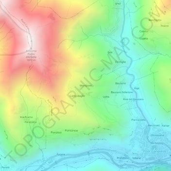
Name: Montpont topographic map, elevation, terrain.
Location: Montpont, Pont Canavese, Turin, Piémont, 10080, Italie (45.41591 7.55377 45.45591 7.59377)
Average elevation: 3,179 ft
Minimum elevation: 1,440 ft
Maximum elevation: 6,122 ft
Thank you for supporting this site ❤️
Make a donation
Make a donation
Gear up for your next adventure:
As an Amazon Associate, this site earns from qualifying purchases at no extra cost to you.