
Thank you for supporting this site ❤️
Make a donation
Make a donation
Gear up for your next adventure:
As an Amazon Associate, this site earns from qualifying purchases at no extra cost to you.
Usigni topographic map
Click on the map to display elevation.
Thank you for supporting this site ❤️
Make a donation
Make a donation
Gear up for your next adventure:
As an Amazon Associate, this site earns from qualifying purchases at no extra cost to you.
About this map
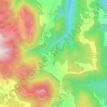
Name: Usigni topographic map, elevation, terrain.
Location: Usigni, Poggiodomo, Perugia, Umbria, 06040, Italy (42.67641 12.91360 42.71641 12.95360)
Average elevation: 3,599 ft
Minimum elevation: 2,362 ft
Maximum elevation: 4,977 ft
Thank you for supporting this site ❤️
Make a donation
Make a donation
Gear up for your next adventure:
As an Amazon Associate, this site earns from qualifying purchases at no extra cost to you.